Research
The High-quality Imaging, Signals, N' Radar (HI-SNR) laboratory develops data assimilation, computational imaging, and signal processing methods in two areas:
1. Multistatic Radar for Environmental Applications
We develop multistatic radars and algorithms for retreiving properties of the environment for the following purposes:
Equip scientists with the tools needed to improve our understanding of the environment. We develop radar-based methods for making measurements of environmental processes at a quality or scale that is not possible with existing tools. This includes projects such as generating 2D maps of the temperature distribution inside glaciers.
Develop systems than enable resource monitoring and improved resource management. This includes projects such as monitoring soil moisture for improved irrigaiton practices.
We are a crib to grave team that puts environmental solutions into the hands of scientists and and environmental agencies.
2. Computational Photography
Research Areas in Computational Photography

Equitable Imaging
We develop equitable imaging methods that ensure beautiful, crisp images for all users. From the technical side, this includes improved skin tone mapping, 3A algorithms, and composite photography that adapt to a user's skin tone and the surrounding scene.
See our publications

Behavioral Studies for Improved Imaging
We research human behavioral processes that influence subjective interpretation of image quality and integrate findings from these studies into improved imaging algorithms.
See our publications
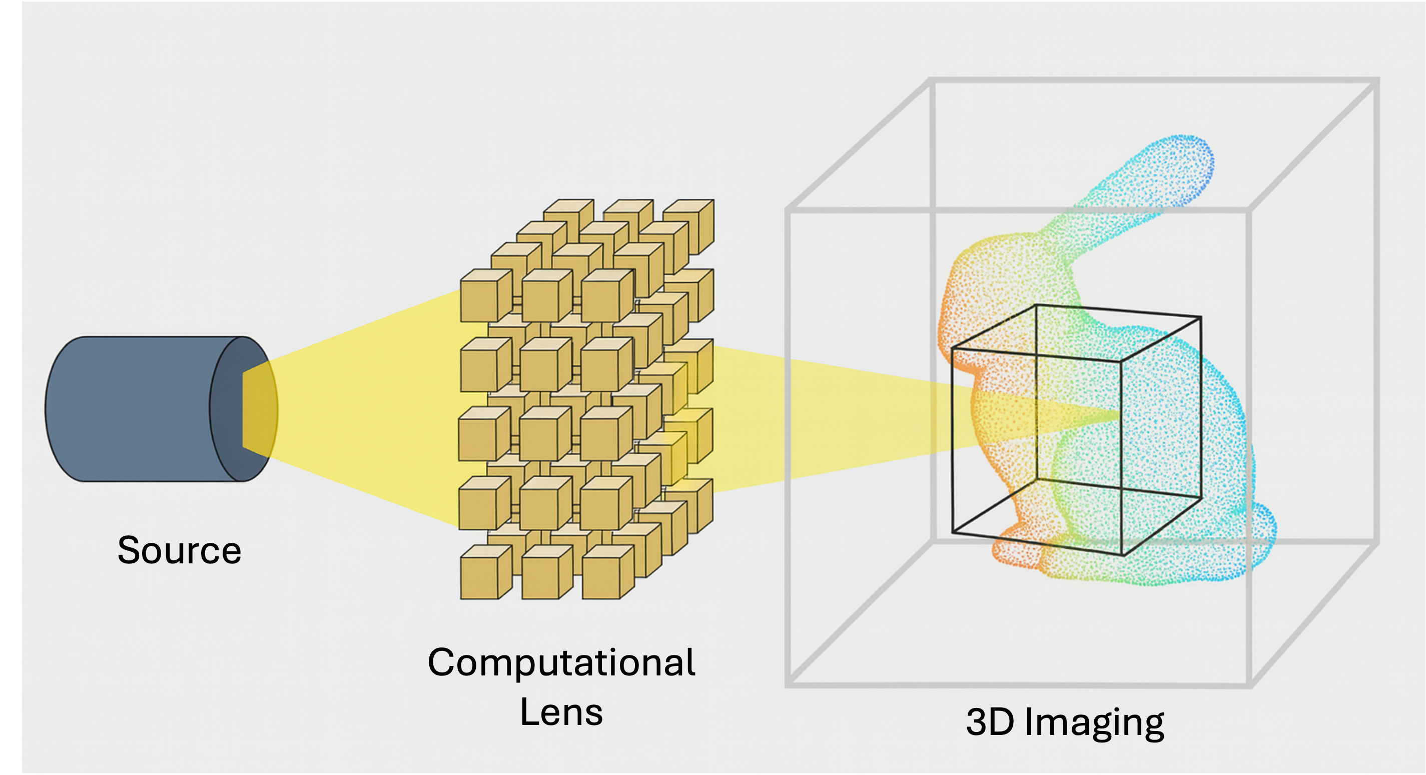
Compressive Sensing
We develop imaging methods and rendering algorithms for reconstructing 3D images from reduced dimensionality data.
See our publications
Research Areas in Environmental Radar
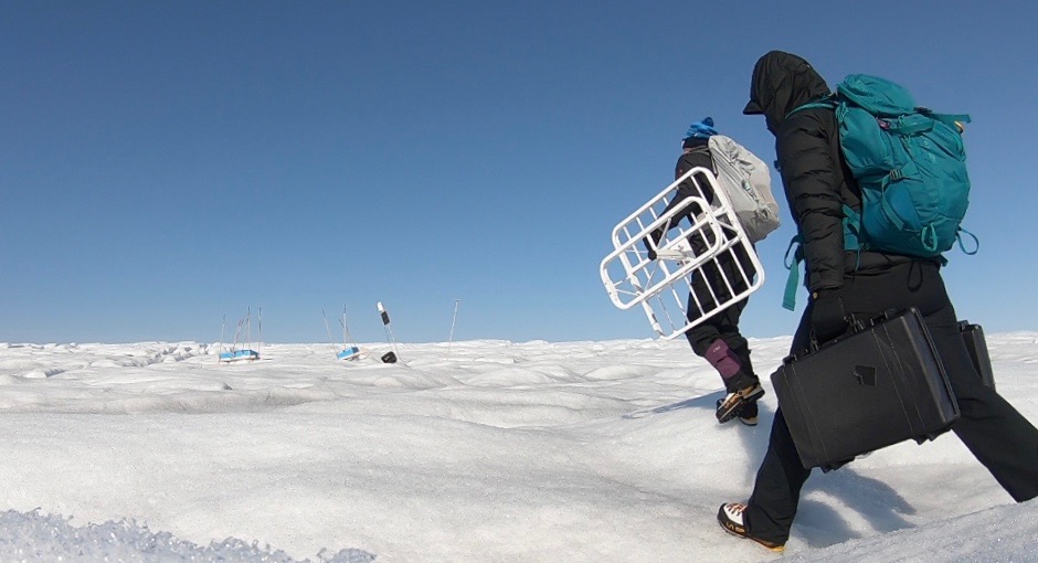
Cryosphere Radars
We are inventing radar techniques to measure ice properties at scales previously unexplored. The systems she develops provide measurements that better constrain ice sheet models to improve the accuracy of sea level rise predictions.
See our publications
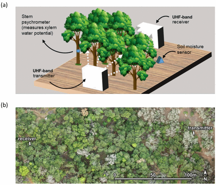
Biosphere Radar
We are developing radars and data assimilation techniques for 3D mapping of vegetation structure and water content to improve wildfire risk predictions, CO2 sequestration assessment, and ecosystem health.
See our publications
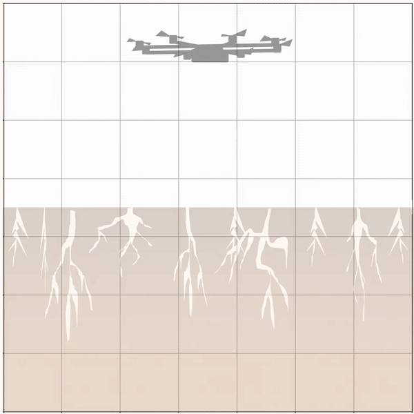
Near Subsurface Radar
We are creating new methods of monitoring our limited resources including drone-based soil moisture estimation and satellite-based aquifer volume retrievals.
See our publications
Highlighted
2020 IGARSS Prize Paper Award Winner
Processing-Based Synchronization Approach for Bistatic Radar Glacial Tomography
This novel processing based synchronization approach allows coherent long-offset radar processing. This is a key enabling technology for radar tomography of glaciers.
N. Bienert, D.. Schroeder, S. Peters, M. Siegfried